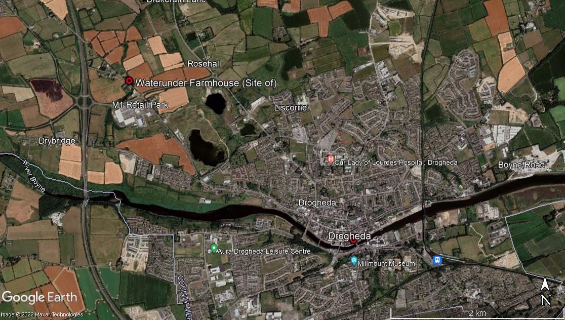
Waterunder Farmhouse, Waterunder, Co. Louth
The loss of this farm complex near Drogheda is a real blow to the rural architectural landscape and vernacular heritage of County Louth
One of the benefits of the ‘covid years’ and the lockdowns they entailed, was having the inclination and time to fully utilise the many history-related resources out there on the internet. HeritageMaps.ie with its wonderful historic maps and inexhaustible databases, is a wonderful resource, as are Google Earth and Maps.
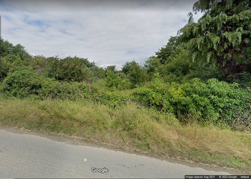
If you download and install Google Earth onto your PC you can access historic satellite imagery. Accessing Streetview through Google Maps gives an opportunity to view street-level imagery taken ten plus years ago when this service launched in Ireland. What an amazing resource this will be in the decades to come.
Combined, these resources allow one to carry out a large amount of research from the comfort of home. I regularly use them to identify sites worth visiting - a quick look on Google Streetview can often reveal if a site is worth visiting or not. They can also serve as an important historical record.
One of the datasets available on HeritageMaps.ie is that of the National Inventory of Architectural Heritage. It was when browsing this dataset I first came across the subject of this article, Waterunder Farmhouse:
Detached five-bay two-storey farm house, built c. 1870, now disused. Rectangular-plan, return to north, porch to south, attached to two-storey smooth rendered building to west. Pitched slate roofs, clay ridge tiles, painted timber bargeboards to gables, red brick stepped corbelled chimneystacks, half-circular cast-iron downpipes. Roughcast rendered walling, smooth rendered plinth and string course. Square-headed window openings, smooth rendered pedimented lugged-and-kneed surrounds to south and east, stone sills, painted timber one-over-one sliding sash windows, two-over-two sliding sash windows to east elevation. Square-headed door opening to south porch, door blocked up; square-headed door opening to north-east, painted timber four-panel door. Set in own grounds; smooth rendered ruled-and-lined outbuildings to south, pitched slate roofs, square-headed openings, painted vertically-sheeted timber doors, corrugated-iron shed attached to north elevation; stone outbuilding to south-west, pitched corrugated-iron roof; bounded by squared rubble stone wall, rendered coping, squared rubble square gate piers, pyramidal capping stones, wrought-iron gates. U-plan rendered outbuildings to south, stone outbuilding to south-west.
This attractive farm complex has maintained much of its character as it has retained many original features and materials which elevate this structure to being one of architectural importance. The modest form of the building and construction of the outbuildings, as well as the varying dates of the outbuildings, tells of the evolution of this site and how it grew over time. The complex, though no longer in use, plays an important role in the rural architectural landscape of County Louth.
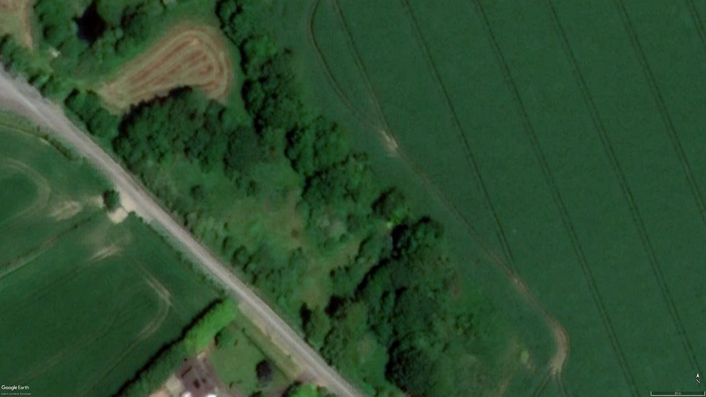
An interesting example of vernacular farm architecture, well worth a visit. Sadly, when I looked at the current satellite imagery I found that nothing of the farmhouse and associated farm buildings could be seen - all have been demolished.
While nothing remains on the site today, an examination of various sources can tell us a little about what has been lost. The evolution of the farm complex can be traced through an examination of various OS maps and historic satellite imagery.
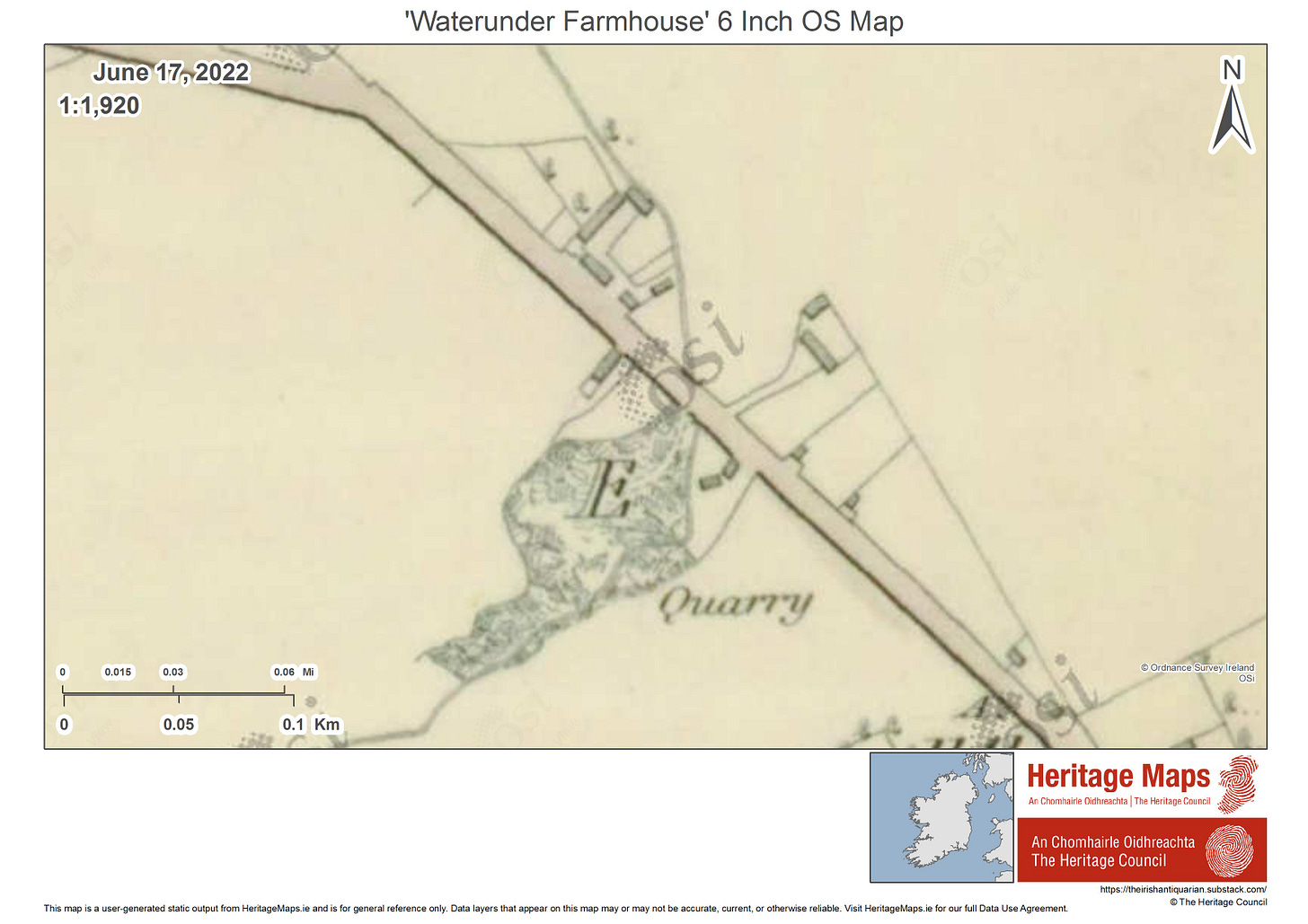
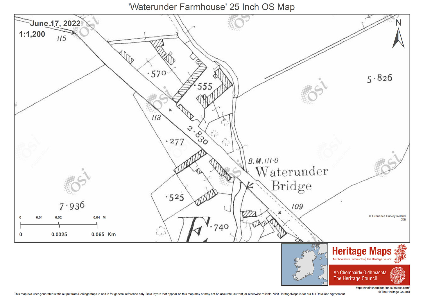
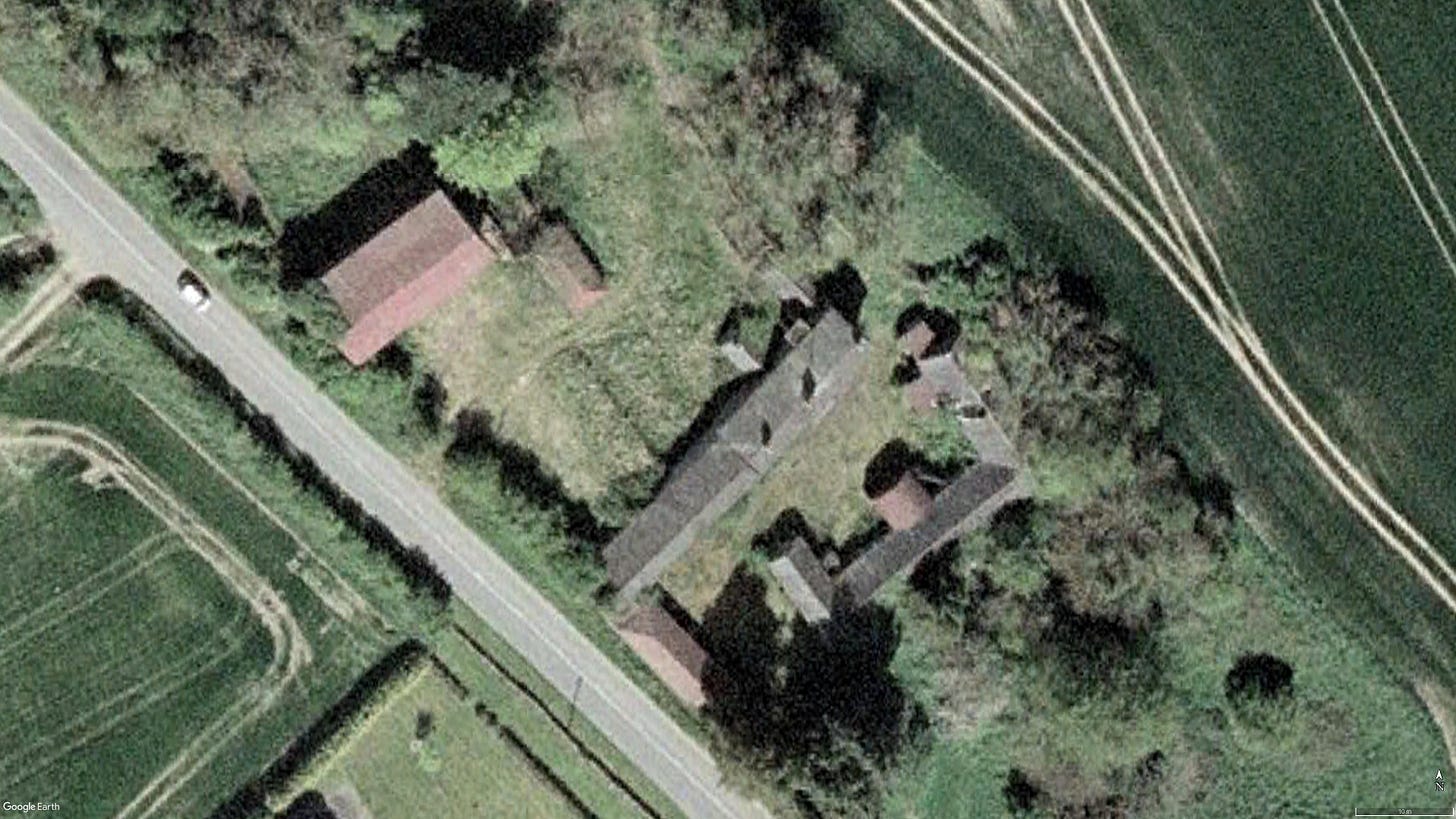
In figure 2 we can see the early footprint of the farm. Over the years the farm evidentially prospered, evidenced by the addition of several additional farm buildings by the time the 25 inch map was drawn around 1900 or so (figure 3). The 2007 satellite image (figure 4) has a very similar layout to that depicted in the 25 inch OS map. Note that in all three images above the footprint of the central building in the yard, that perpendicular to the main road, is the same. This central range of buildings included the main farmhouse, with some attached outbuildings.
I could only find a handful of photographs of the buildings, with those from the NIAH being the most useful.


Note the difference in window size between the ground and upper floor. While an examination of the building would be necessary to say definitively, something which is sadly impossible, it is very likely that the lower story is the original 18th century farmhouse, with the upper story being added in the 19th century as the farm prospered. “Raising up” older farmhouses was a common way of extending the available living space. In this instance, it was done with some attractive flourishes.
In the course of my research into this farm complex, I examined two planning applications that were lodged in 2005 and 2007. Both were to demolish the farmhouse and outbuildings, to be replaced by commercial/industrial buildings. Both planning applications were rejected for a variety of reasons, including the impact on traffic and the lack of adequate sewage capacity. Included in the planning applications were a number of interesting drawings of the farmhouse and primary outbuildings which I have included below. Of particular interest is the large outbuilding located opposite the house. The size and form of this building would appear to reflect a period of prosperity on the farm.
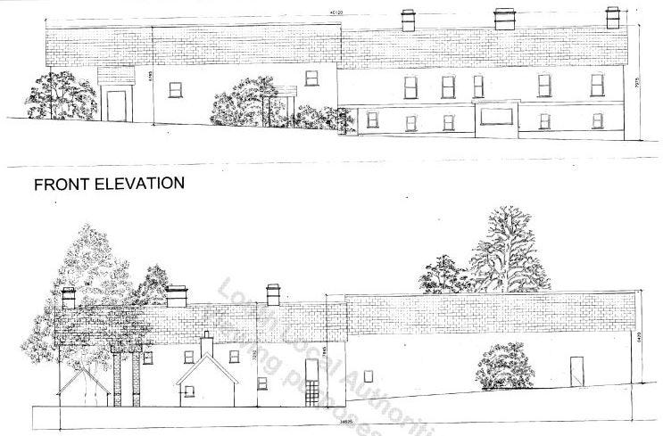
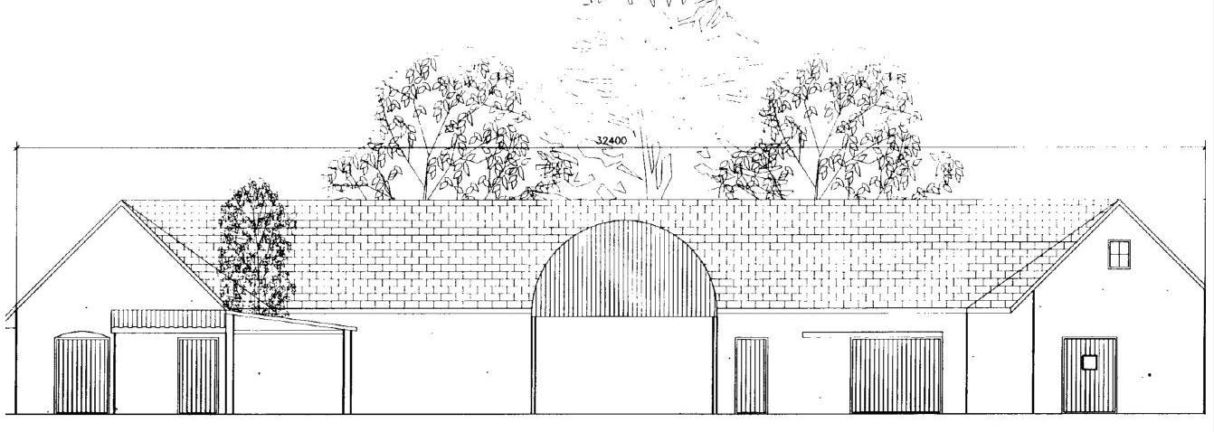
In 2008 Louth County Council opened a file (reference 08 U1061) regarding the demolition of the farmhouse. I contacted LCC to find out more and they informed me that:
Initially the file was opened due to the demolition of the structure. It was later established the property was demolished due to fire damage and the file was closed.
Many thanks to the staff in Louth County Council’s Planning Enforcement Section who were very helpful and promptly answered my queries.
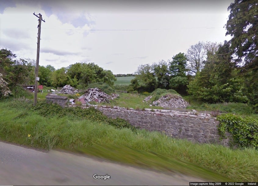
While time must march on, and not everything can be preserved or saved, it is quite sad that this interesting example of vernacular farm architecture was lost.
If you know anything further about this farm or those who lived there, please do get in touch. I would love to hear from you and perhaps expand this article to include further detail. The buildings may be gone, but the history and story can still be preserved.
Sources and Further Reading
https://www.buildingsofireland.ie/buildings-search/building/13902408/mell-louth (NIAH entry)
Planning Application: 051803 (Louth County Council)
Planning Application: 07654 (Louth County Council)
Shaffrey, Patrick and Shaffrey, Maura. ‘Irish Countryside Buildings: Everyday Architecture in the Rural Landscape’. The O’Brien Press, 1985.


