As the Coronavirus rages on and we live within our 2km radius bubbles, I, like many others, have been paying greater attention to my local area in search of sights and sounds to stimulate the senses and excite the mind. Often we ignore or take for granted that which we have on our doorsteps. How many times have I cycled 50kms to visit a site and ignored one in walking distance? Too many times reader! Now, however, there is no other option, walking distance it is.
Mornington is an old, sprawling village/townland located on the southern bank of the river Boyne's estuary, only five or so kilometres from Drogheda. It is said that St. Patrick landed here when beginning his great mission in Ireland. Certainly, there has been a settlement here for generations evidenced by the old graveyard and medieval church remains (more on these another time!).
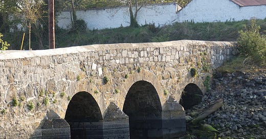
At old Mornington Village, adjacent to the aforementioned graveyard and ruins, as well as a 19th century Roman Catholic church (abandoned in favour of a nearby, newly built, church in 1989) a small stream empties under a stone bridge into the Boyne.
Mornington Bridge
The National Inventory of Architectural Heritage (NIAH) describes the bridge as a "triple-arched road bridge, built c.1840 with a disused flood gate to the south elevation and breakwaters to north elevation. Rubble stone walls with ashlar limestone breakwaters and voussoirs. The rubble stone used for the construction of this bridge contrasts with the ashlar voussoirs and breakwaters, which are clearly the work of skilled craftsmen. The remains of the flood gates act as a reminder of a time when the water flow was controlled."
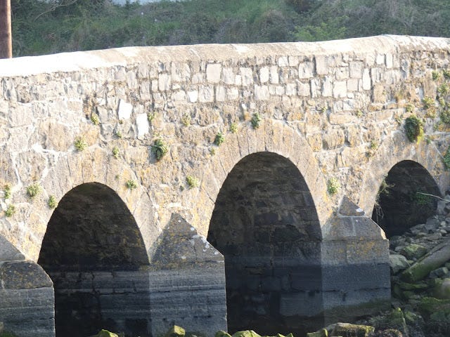
"Voussoirs" are the carved and shaped stones that form the arch. The referenced "breakwaters" are probably more accurately described as "cutwaters". They are the edged projections at the sides of each arch. They serve to reduce the force of the current and protect the arches and bridge from scouring or being undermined and eroded by the flow of water. They also protect the bridge from flood debris such as logs etc. by absorbing the impact of the blow and deflecting it. On Mornington Bridge they are located on one side only, that which faces on to the Boyne.
While the bridge is dated by the NIAH to around 1840 it may be a little earlier, certainly a bridge existed here long before that date.
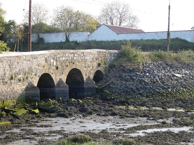
A closer look at the cutwaters and voussoirs. The eagle-eyed among you will notice some differences between the bridge as seen in the NIAH photograph (c.2002) and my own photographs. Firstly we can see that a large amount of rubble has been placed on the western side of the "Boyne side" of the bridge, perhaps to buttress a leaning or collapsing wall. It has also partially blocked one of the archways, burying one of the cutwaters. It seems, however, that the vast majority of the water flows through the larger central arch.
Mornington Bridge, with the tide out. Observe the large deposit of rubble and the partially blocked arch, One of the cutwaters is no longer visible, buried under the rubble.
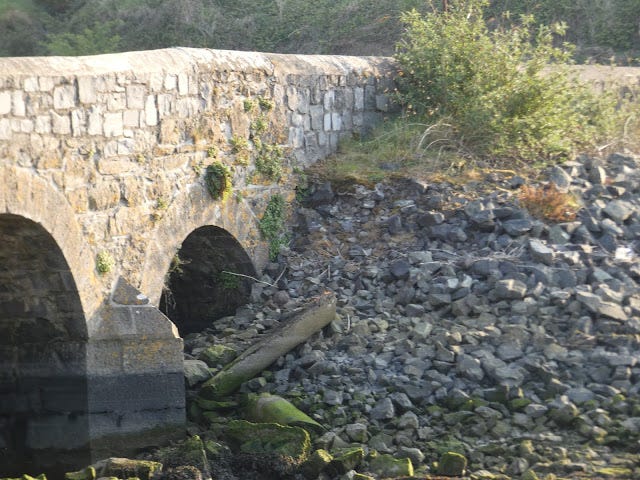
A closer look at the rubble and buried cutwater. The rubble, if indeed it is a repair, is not the only repair the bridge has undergone. It appears that the bridge has, on a number of occasions, been struck by vehicular traffic and damaged. It is just as well that the finest portions of this bridge are the cutwaters and voussoirs with the remainder being made up of rubble. Currently (April 2020) the bridge is in a state of considerable disrepair on the "stream side" as the following pictures show.
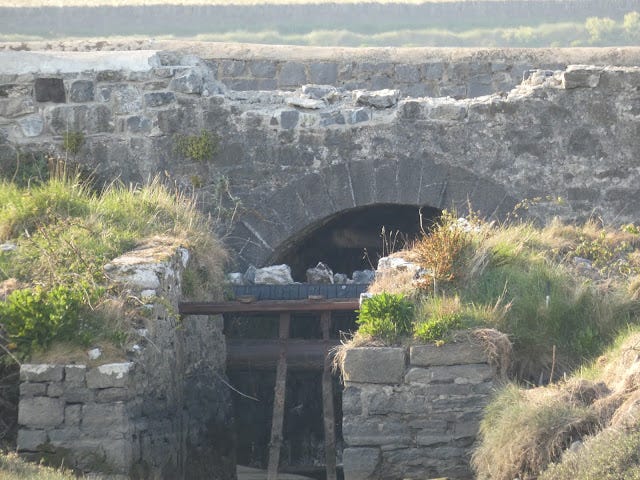
The roadside wall, or bridge parapet, has been recently smashed with rubble being knocked into the stream below. Some rubble is laying upon pipework. It also appears that the damaged portion was a recent repair itself! The remains of the floodgate are also visible in this photograph.
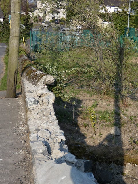
View of the damage from the road. It must have been a big impact!
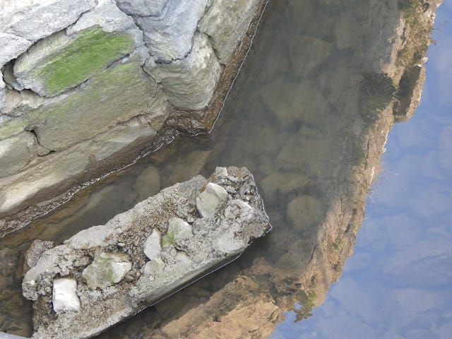
A portion of the parapet knocked into the stream.The northerly, or "Boyne side" of the bridge shows evidence of having been similarly damaged and repaired in times past. Motoring offenses, especially speeding, are rampant in this area and were no doubt a major contributing factor to the damage.
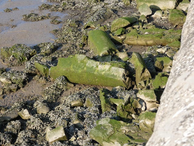
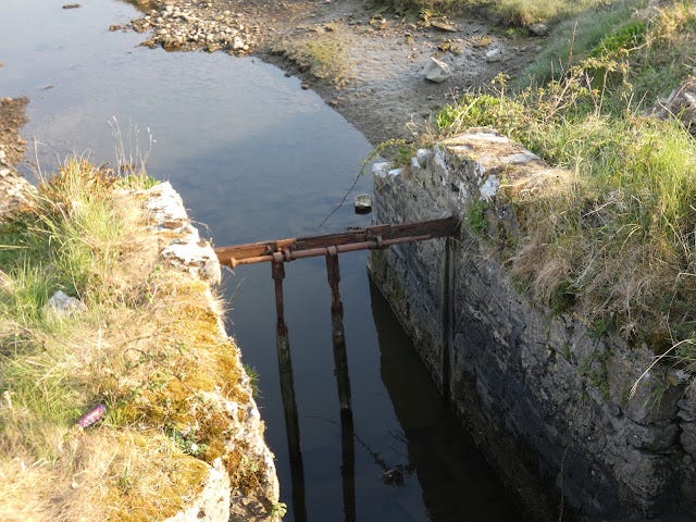
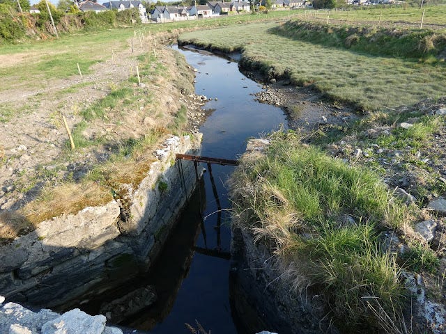
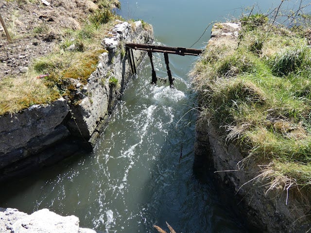
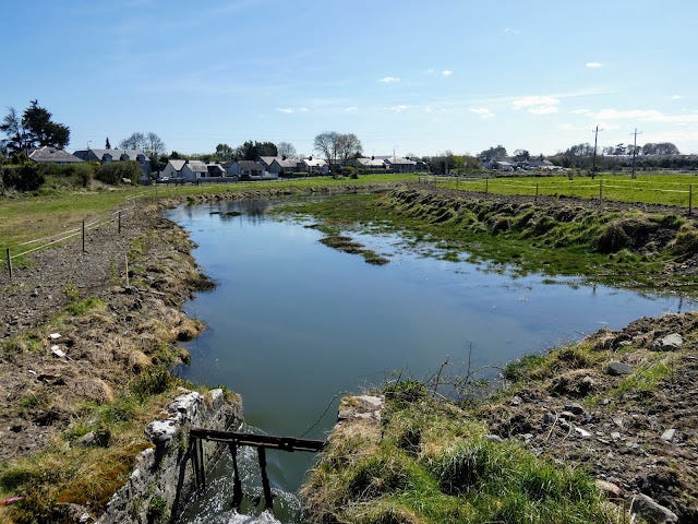
Sections of the bridge parapet knocked into the Boyne estuary. As previously mentioned, and evidenced in some of the pictures, the remnants of a floodgate can be seen on the southern, or "stream side" of the bridge. This floodgate would have been used to control the flow of water from the stream into the estuary and vice versa.
The Stream and Floodgate
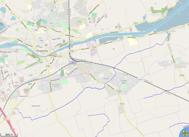
The stream, alternatively called Stameen Stream and Colp Stream, appears to rise adjacent to the Platin Road at Lagavoreen (beside the Boann Distillery, Drogheda). The stream flows from there, towards Beamore where it passes near the site of the medieval Cistercian grange of de Bello Becco (Beaubec), then skirts the Five Oaks housing estate and proceeds under the Dublin road. It again skirts a housing estate, Stameen, before meandering around the grounds of the Boyne Valley Hotel (formally Stameen House). Here we can see how the stream, for a portion, marks the border between the counties of Meath and Louth. From the Boyne Valley Hotel/Stameen House the stream flows to Mornington where it enters the Boyne estuary under Mornington Bridge.
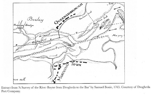
The floodgate was used to control the flow of the stream and estuary. The Boyne is a tidal river, huge volumes of water flow up and down the Boyne with the tide. For hundreds of years, the region's inhabitants have sought to control and change the flow of the river. Today, the river flows deep in a narrow channel, pinned in at low tide by walls and piers. The was done in order to allow larger ships to travel the river. Historically, the estuary at Mornington was very wide with the flow of the river quite split, and the channel shallow as the diagram below illustrates.
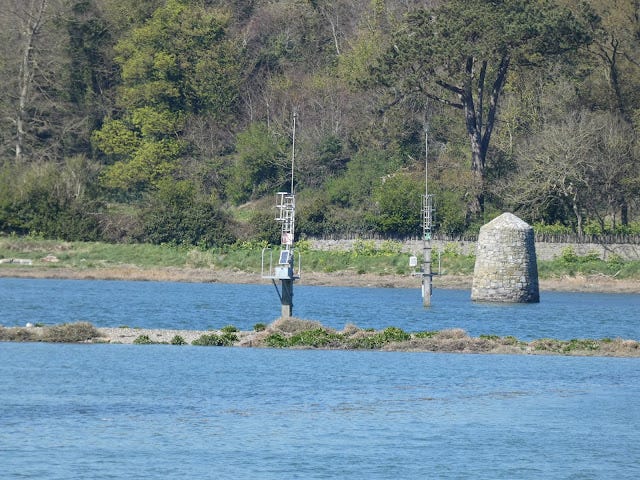
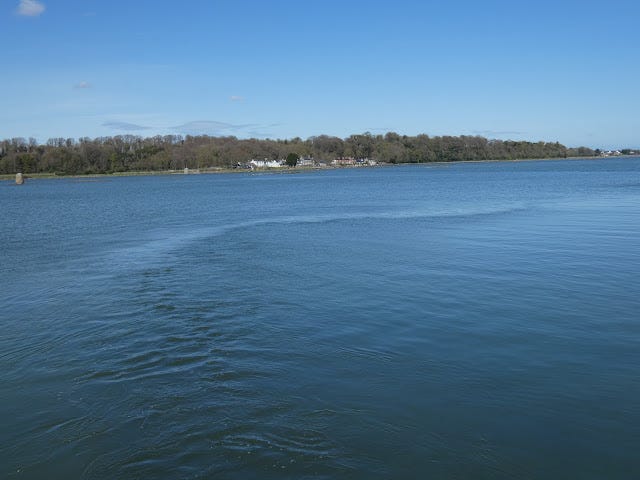
The estuary today is still quite wide, almost 2km at points, but it is only "full" at high tide, and the main flow of water is confined to the central channel, marked by navigation beacons.
Navigation beacons, modern and 19th Century, marking, at high tide, the Boyne's main navigable channel.
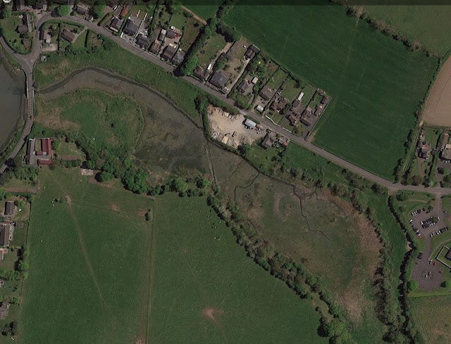
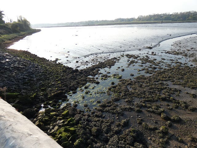
The tide also has a major effect on the Stameen/Colp stream, in fact, it has its own little estuary! Normally the stream is of modest size and flow, but with high tide it swells to many times its ordinary size.
Satellite image at low tide. You can see the normal modest flow of Colp/Stameen stream towards Mornington Bridge on the left of the image. Also apparent are the large areas of various shades of grey, green and brown that vanish underwater at high tide.
As can be seen, a large amount of water flows with the tide under Mornington Bridge and through the floodgate. Floodgates are used to admit or exclude water in order to control the volume. At Mornington, the floodgate is not noted on the earlier OS maps, it first appears on the 25-inch map which perhaps suggests a date of not before the mid 19th Century. The floodgate would have been operated manually in line with the flow of the tide, so obviously the gate operator would have had to have lived nearby.
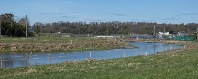
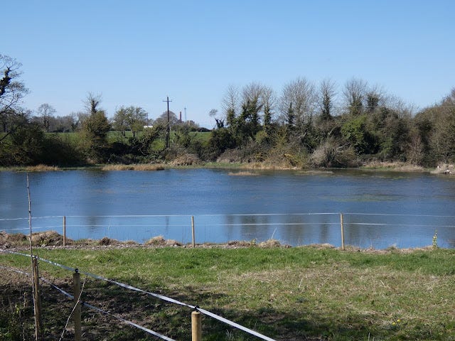
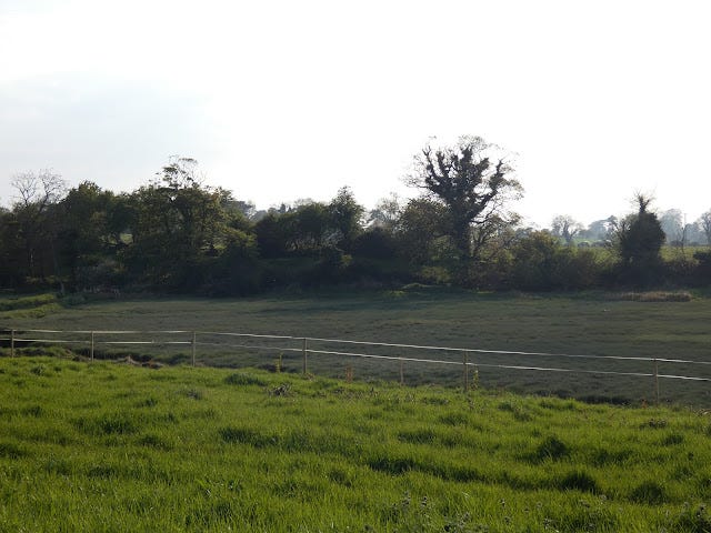
The immediate question that comes to mind is why was the floodgate erected? Why is it no longer necessary? Here I enter the realm of speculation, no doubt a Mornington local would be better placed to answer this question, but two speculative answers come to mind. The first is rather obvious, by closing off the flow of the water as the tide comes in, the stream would no longer flood the surrounding land as depicted in my photographs. Indeed, in times past the flooding may have been even greater, and the demand for land higher. The flood gate would have perhaps saved land from flooding and freed it up for use.
Another possibility has to do with the Boyne itself. I have previously touched on how major engineering works were carried out on the river to improve its navigability. These works, as mentioned, involved the construction of piers and walls in the 18th and 19th Centuries to create a permanent central channel. This channel was, and continues to be, dredged in order to increase its depth. The river bed of the Boyne is largely sandy, and one effect of more water being confined to a central channel is that it increases the scour on the river bed - the water erodes it more and naturally deepens the river. Perhaps part of the rationale for constructing the flood gate was in order to keep more water, as the tide comes in, in the Boyne as part of these engineering works?
All we can say for sure is that the floodgate has long fallen out of use.
Concluding Thoughts
Mornington is a charming village with a lot of evident history. The bridge and floodgate are altogether more modern than the obvious medieval ruins nearby, but nevertheless interesting. It is very much worth visiting, particularly when the local pub, Moran's, is open.
I have crossed the bridge many times without a second thought, but having been forced to slow down and appreciate things in my locality that little bit more it has been a rewarding experience - I wouldn't have expected a simple bridge and small stream to have aroused my interest so much, both in terms of research and photography, but it has.
I hope you enjoyed this article, hopefully a local may make an appearance in the comment section and provide some more information about the floodgate and the damage to the bridge.
Hopefully, the bridge will be repaired soon, and drivers will take more care!
References and Further Reading
Journal Articles
A History of Queensborough, Focused on Queensborough House, Raymond E. Healy and Grattan C. Healy, Journal of the County Louth Archaeological and Historical Society, Vol. 28, No. 1 (2013), pp. 77-96 (20 pages)
The Port of Drogheda 1790-1850: An Era of Regeneration and Resurgence, Ned McHugh, Journal of the County Louth Archaeological and Historical Society, Vol. 26, No. 2 (2006), pp. 151-326 (174 pages)
Pollard, Edward & Brady, Niall. (2013). Archaeology and Development in a Maritime Context, Highlighting Drogheda and the Boyne Estuary as a Case Study.
https://www.academia.edu/28114199/Archaeology_and_development_in_a_maritime_context_highlighting_Drogheda_and_the_Boyne_estuary_as_a_case_study
Maps
https://heritagemaps.ie (OSI Maps).
Journal of the County Louth Archaeological and Historical Society (Bouie Map)
Other Blogposts/Websites/Presentations
Hidden Arches - Unseen Assets. – Presentation by Gary Salter BE, MSc, C.Eng, MICE, MCIWEM, MIHT. Conservation Accredited Engineer Delivered to and at the request of TII/NRA National Roads Conference, Killarney, 23rd September 2015. Link below downloads the file from the Transport Infrastructure Ireland website.
https://www.tii.ie/tii-library/conferences_and_seminars/nrc/nra-nrc-2015/1.3_G_Salter_Hidden-Arches.pdfJ
https://www.buildingsofireland.ie
Books
Rynne, Colin, 'Industrial Ireland 1750 - 1930 An Archaeology', The Collins Press 2015

