Exploring a Medieval Souterrain in Oldbridge, Co. Meath
Going underground to learn all about souterrains
As we head into winter (and unfortunately lockdown once again here in Ireland) it is a good time to reflect back on what have been an extraordinary few months. There is enough doom and gloom out there without adding to it, so we should to try and focus on some of the bright spots amid what has been a very difficult time due to the Covid19 pandemic.
One of the things which I have enjoyed most over the past few months is visiting numerous sites, mainly in Louth and Meath, researching and taking photos and video for future articles on this site. One of my favorite trips was a somewhat impromptu one when a friend asked me a few months ago if I would be interested in exploring a souterrain in Oldbridge Co. Meath (near the Battle of the Boyne Visitor Centre). I jumped at the chance.
What is a Souterrain?
Souterrains are man-made underground structures, often referred to in Ireland, on maps in particular, as "caves". The word "souterrain" comes from French, "sous" meaning under and "terrain" meaning ground. The vast majority of souterrains in Ireland are considered to be medieval and were mainly used from roughly around 750AD to 1250AD, but there are earlier examples. Souterrains are basically underground passages, which may or may not have a chamber, or multiple chambers, of some description.
There are three main categories of souterrains, distinguished by their material and manner of construction.
Tunneled souterrains: These are souterrains that are, as the name suggests, dug straight into the earth or bedrock like a tunnel.
Drystone souterrains: These are the most common type in Ireland and consist of passages and chambers built out of stone, with stone lintel or corbelled roofs. They would have been constructed by first digging trenches and lining the sides of a passage with stone and putting a stone roof on top. This would then have all been buried again in the trench, hiding it from view.
Wooden souterrains: These are less common and would have been built in a similar way to how drystone souterrains were constructed, but with wooden timbers instead of stone. Given that these were constructed out of organic material, it would not be expected that many would survive to today, in normal conditions, as the wood would have rotted away long ago.
In his book The Souterrains of Ireland Mark Clinton suggests that there are two main types of passage, restricted and unrestricted and that these can be differentiated by the size of the passage. Clinton gives a suggested set of dimensions by which to differentiate the two types of passage. Unrestricted passages are those which have a height of 0.95 meters or greater and an average width of 0.70 to 1.10 meters at ground level - these passages are big enough to easily navigate.
Restricted passages are those of less than 0.95 meters in height and have a width of 0.60m to 0.90 meters at ground level - these passages are much more difficult, by design, to navigate. Access can only be gained with difficulty, greatly hunched over or even by having to crawl on all fours.
What exactly souterrains were used for has been a matter of some debate over the years. It has been suggested that people may have lived in them, used them to store food, valuables or other supplies (including slaves!) or as places of refuge to hide from attackers. Today the consensus (Clinton 2001) seems to be that they were mainly used as places of refuge, but they also, particularly the simpler examples, served as food stores, either primarily or on an ad-hoc basis. Interestingly, the medieval law-tracts tell us that (per Clinton 2001) the cost of a souterrain was two cows, the same as a cashel.
Once thought to be mainly associated with enclosed medieval settlements (ringforts etc.) the archaeological evidence has demonstrated that souterrains are wedded to no particular settlement type, save that they are associated with settlement. That is to say, people lived nearby!
Location of the Oldbridge Souterrain
There are a number of souterrains located in the townland of Oldbridge in County Meath, positioned close to the river Boyne. As you can see in the satellite image and the map below, the souterrain we are concerned with in this article is located close to the ruins of Glenmore House.


The souterrain, ME020-079, is located in a field called "Glenmore Lawn", as per the Meath Field Names Project (http://www.meathfieldnames.com). The exact location is marked on the Irish Antiquarian Historic Sites Map.
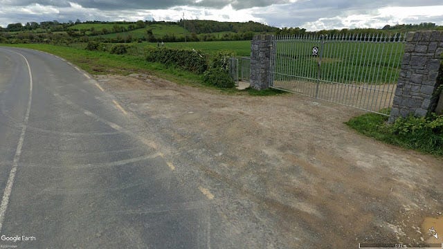
General access to the site is quite straightforward, the easiest way is to park at the large gate on the Sheephouse-Oldbridge bypass, where you can then enter by a pedestrian gate. This is a lovely area for a walk, it takes you down past the ruins of Glenmore House and you can walk on the river bank back towards, and gain access to, Oldbridge House (Battle of the Boyne Visitor Centre).
Oldbridge Souterrain (ME020-079)
This souterrain is a somewhat recent discovery. It is absent from the Archaeological Inventory of County Meath (published in 1987). The current entry on the National Monuments Service (NMS) Sites and Monuments Record (accessed via HeritageMaps.ie) tells us that that the souterrain is:
"Situated just off the brow of a ridge on gently sloping land overlooking the Boyne river valley to the north. The remains of a souterrain passage is visible via three gaps in the roof that were exposed as result of ploughing resulting in a shallow depression c. 6m x 4m. The passage, 0.7m wide and averaging 0.70m high in the exposed sections runs approximately north-south and it proved possible to examine only a small section of it where lintels have been removed. The walls are composed of dry-stone walling on top which rests a series of lintels. The passage measures at least 9m in length and curves northwards from the exposed section in the depression. Further collapse of a section of the souterrain took place in 2014 some 3.8m north of the existing openings. The souterrain appears to terminate immediately south of the southern-most gap but it is very collapsed in this area and the visible corner may represent an angled turn with the passage turning towards the east."
Like many souterrains this one was discovered via ploughing. Due to soil erosion and deeper ploughing over the years many souterrains have been discovered (with many more yet to be discovered), with the plough sometimes striking lintels or chamber capstones. By looking at older aerial and satellite images of this site we can see that the land directly over the souterrain was farmed and ploughed, presumably until this was no longer possible due to the stones located just below the surface.


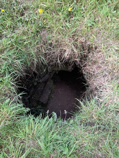
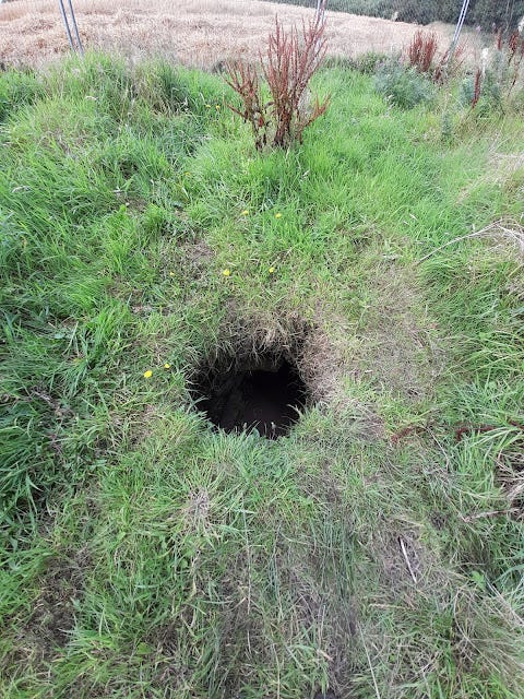
The souterrain today is now fenced off from the surrounding field. Parts of the passage of the souterrain are collapsed. Due to this, it is not clear how long the passage of the souterrain originally was, or indeed where exactly the original entrance is. Access today is through sections of the passage which have had their lintel, or roof, removed.
The archaeologists of the NMS state in their record that the "souterrain appears to terminate immediately south of the southern-most gap but it is very collapsed in this area and the visible corner may represent an angled turn with the passage turning towards the east". Upon investigation this is indeed the case, it is collapsed. The passage may have gone on much further than the visible remains today indicate.
My friend, who had visited before and was familiar with the site, assured me that the passage to the north where it begins to curve was not collapsed and could be explored. So down we went to investigate.
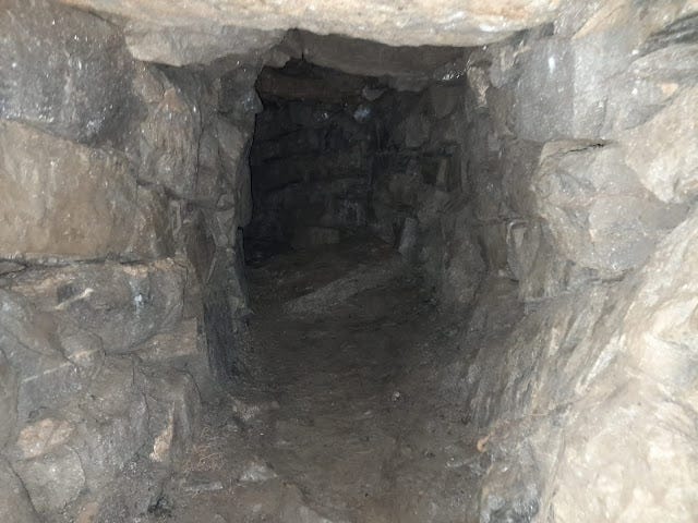
As you can see from the photo above the entrance was quite tight. The record states that the passage has an average width and height of 0.70 meters. Regrettably, I did not bring any ranging poles, scales or tape, but those measurements felt about right. I'm six foot tall and was only able to navigate the passage with a combination of crouching and primarily crab walking. This was quite difficult as the passage was almost pitch black - I had to use the light on my phone (I came quite unprepared) to see where I was going and to avoid banging my head. It seems clear that the passage is of the restricted type, designed to be difficult and slow to navigate through.
This photo was taken just inside the entrance pictured above. The passage can be seen to curve to the left.
The remaining uncollapsed passage is not massively long, certainly a fraction of what the full length of the passage originally was. Even so, although it only took a couple of minutes to carefully scramble through, I was very happy to reach the end of the passage and to discover that it terminated in a chamber large enough to stand in.
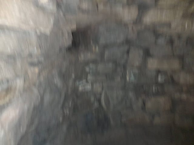
There are some regional characteristics that some souterrains share. In Meath and south Louth "beehive chambers" are relatively common and this was the case here. A "beehive chamber", such as this one, is a circular chamber that narrows as it increases in height. The passage ended in a relatively large beehive chamber, tall enough to stand in and easily large enough for several full-size adults. The chamber is corbelled (progressively overlapping stones narrowing the space as they go up), with two large capstones on top.

The chamber is pitch black and a light is necessary. On the day we visited it was very warm outside, but the chamber itself was cool, to the extent that after a few minutes we could see our breath. I imagine that perishable foodstuffs, such as dairy products, could be stored quite well here.
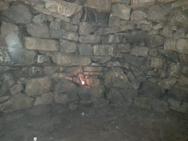
An interesting feature of the chamber is that there is an air-vent towards the "back left" (as one stands at the chamber entrance) of the chamber. This air-vent would have connected to the outside and would have been used for, as the name suggests, supplying air to the chamber and preventing suffocation. The surface opening of the air-vent would be located nearby, often disguised. The presence of an air-vent clearly suggests that occupancy of the chamber was expected on occasion. Air-vents may also have been a way in which people outside the chamber could communicate with those inside. My friend had brought a candle with him and held the lit candle to the vent. The flickering and draw on the flame suggests that the air vent still functions and has not been blocked up. I did not search for the surface opening of the vent, a task for another day!
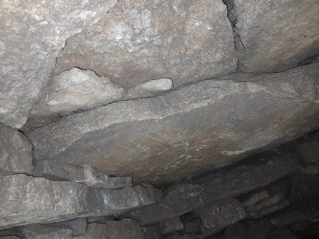
As mentioned previously, the souterrain passage has collapsed in a number of places. An examination of the remainder of the passage made clear that the rest of the souterrain is in danger of collapse too. This can clearly be seen from looking at the lintel over the door of the entrance from the passage into the chamber.
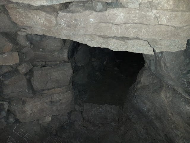
The entrance to the chamber is in danger of collapse, if not the chamber itself. Clearly, this souterrain is dangerous to enter, and in hindsight it was a bit foolhardy to enter when other sections of it had collapsed already. I had intended to take a look at the souterrain and return later with more equipment and a decent camera, but I decided not to do so for obvious reasons, hence the rather poor quality of my photographs, they were all taken with a camera phone.
Given the size of the chamber, the restricted passage and the air-vent it would seem probable that this souterrain was intended for use as a place of refuge. It is easy to imagine in times of attack that perhaps the women and children of the settlement would retreat into the souterrain to hide, protected by a hidden entrance and by the restricted passage, meaning that if it were found by attackers it would be difficult to gain entry without making oneself very vulnerable to attack from those in the chamber. The air-vent and relatively long passage would have given some protection from being burned or suffocated out and would also have served as a useful means for receiving the "all-clear" from the outside. The best defense however, would clearly have been for the souterrain to remain undetected. Records suggest that raids on places like our souterrain in Oldbridge (probably an unenclosed tillage farm type settlement) would probably have been carried out at night. It would be very difficult to discover a small hidden entrance to a souterrain in the dark!
The souterrain may have also been used as storage, but this would seem to me to have probably been an incidental use rather than a primary one. If it were primarily used to store food why would they have made the passage so difficult to navigate? Remember, the original entrance passage to the chamber would have been much longer, including the collapsed sections. I only had to navigate a small section of the passage and this was difficult enough to do when holding and using a smartphone as a torch, carrying down foodstuffs would have been really quite difficult and impractical.
As enjoyable as my visit was, and as much as I would like to go back into the souterrain with measuring equipment and a good camera, and to examine the various lintels to see if any are reused Ogham stones, it seems too dangerous. Souterrains were an important, and sometimes underappreciated, part of medieval settlement and life in Ireland. This souterrain at Oldbridge is an interesting example located in an area overflowing with history. It is worth a visit if you are in the area, but I would advise visitors to only look at what can be seen of the souterrain from the surface and to just look down the passage, rather than enter it.
This is a dangerous structure that may collapse further. Stay out!
References and Further Reading
Maps
https://www.heritagemaps.ie/WebApps/HeritageMaps/index.html (OSI Maps and NMS Record).
https://www.google.com/earth/ (Satellite images).
https://www.google.com/maps (Streetview images).
Other Blogposts/Websites/Links
http://www.meathfieldnames.com/
http://www.abandonedireland.com/Glenmore.html
Books
Clinton, Mark, 'The Souterrains of Ireland' (Wordwell 2001).
'Archaeological Inventory of County Meath' (Dublin: Stationery Office, 1987).
Stout, Matthew, 'Early Medieval Ireland 431 - 1169' (Wordwell, 2017).
Ó Súilleabháin, Muiris, Downey, Liam & Downey, Dara, 'Antiquities of Rural Ireland' (Wordwell, 2017).




Very interesting David. Maith thu